INFOS & SERVICE
OUR OTHER WEBSITES
")
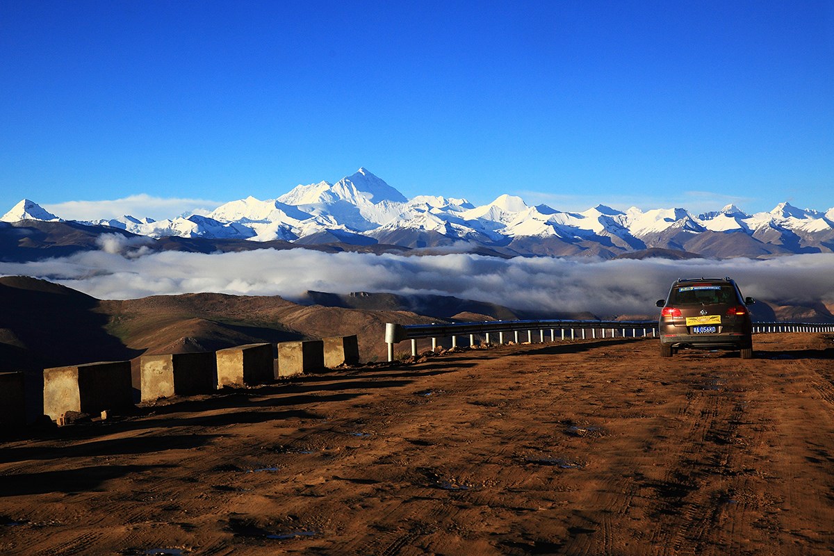
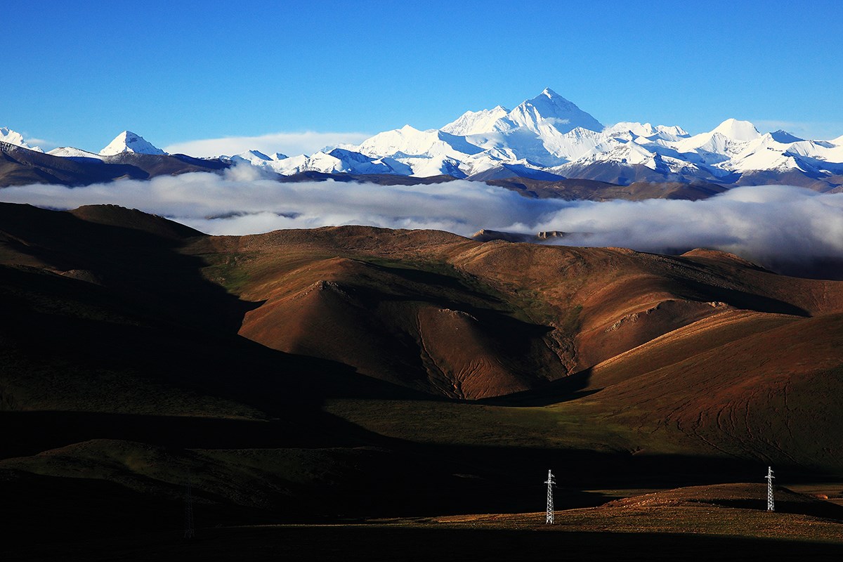
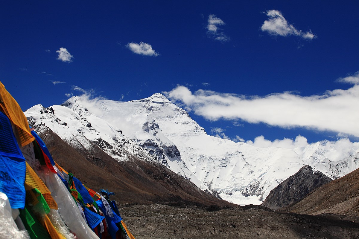
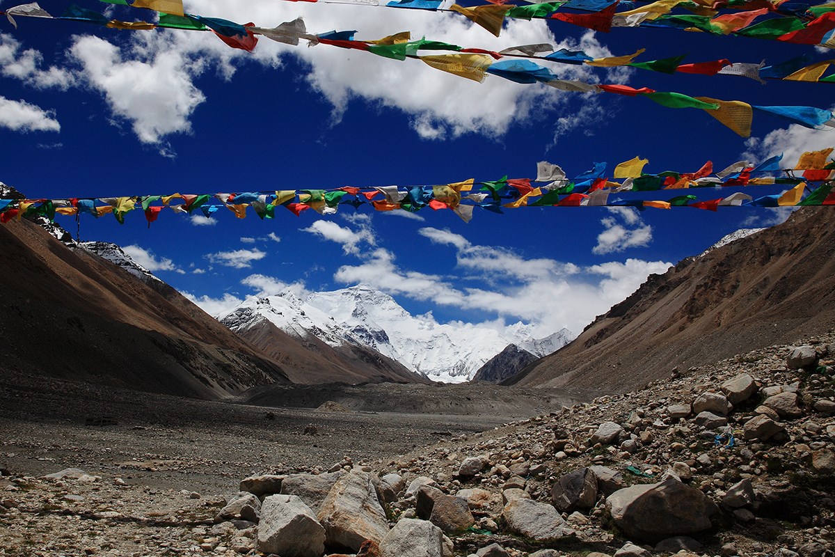
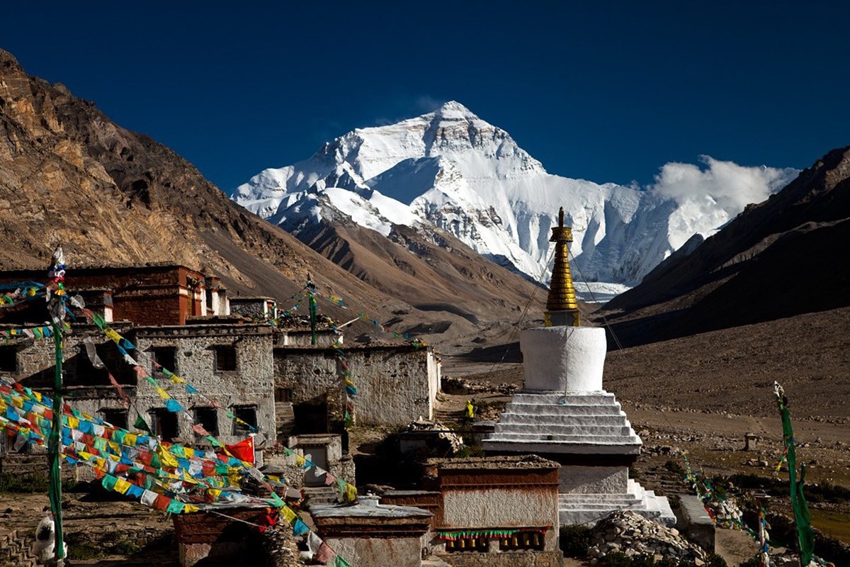
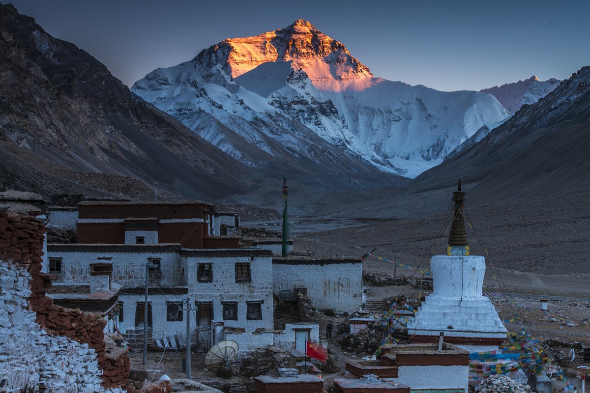
Qomolangma (also called Everest), the main peak of the Himalayas, is the highest peak in the earth. At an altitude of 8848.43 meters, it is located at 86.9°E and 27.9°N, right on the east section of the Sino-Nepal border, with the north slope in Tingri County of the Tibet Autonomous Region, the people's Republic of China, and the south slope in the Kingdom of Nepal. In Tibetan Language, Qomolangma means "Goddess of the Earth". And in Nepali it is called Sagarmatha what means "Goddess of the Sky".
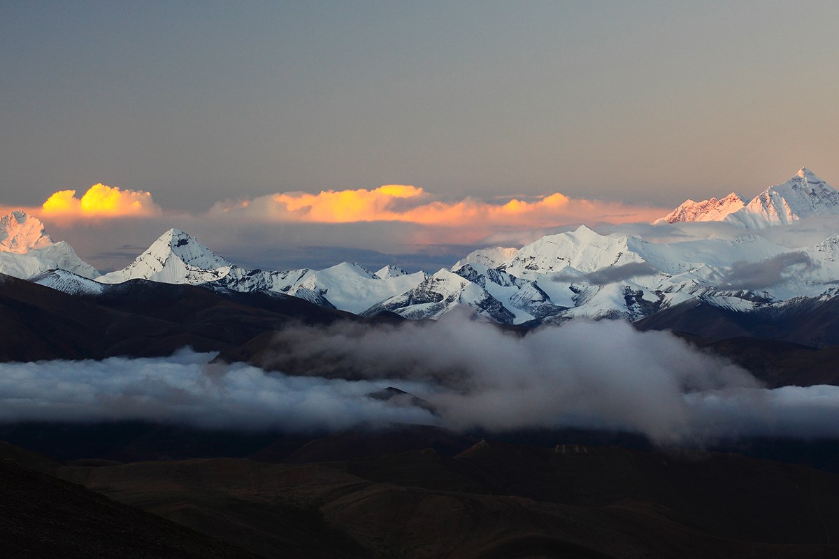
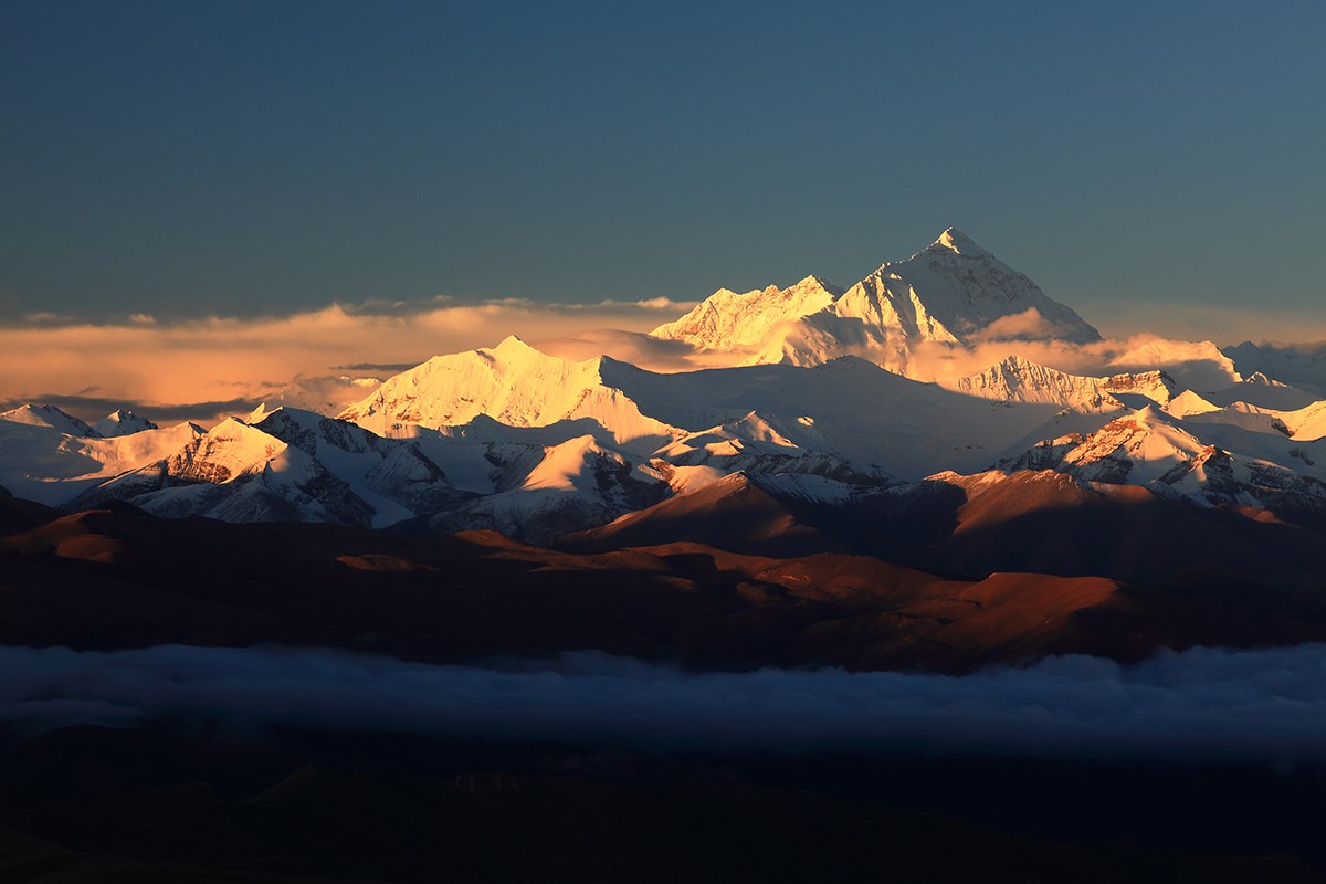
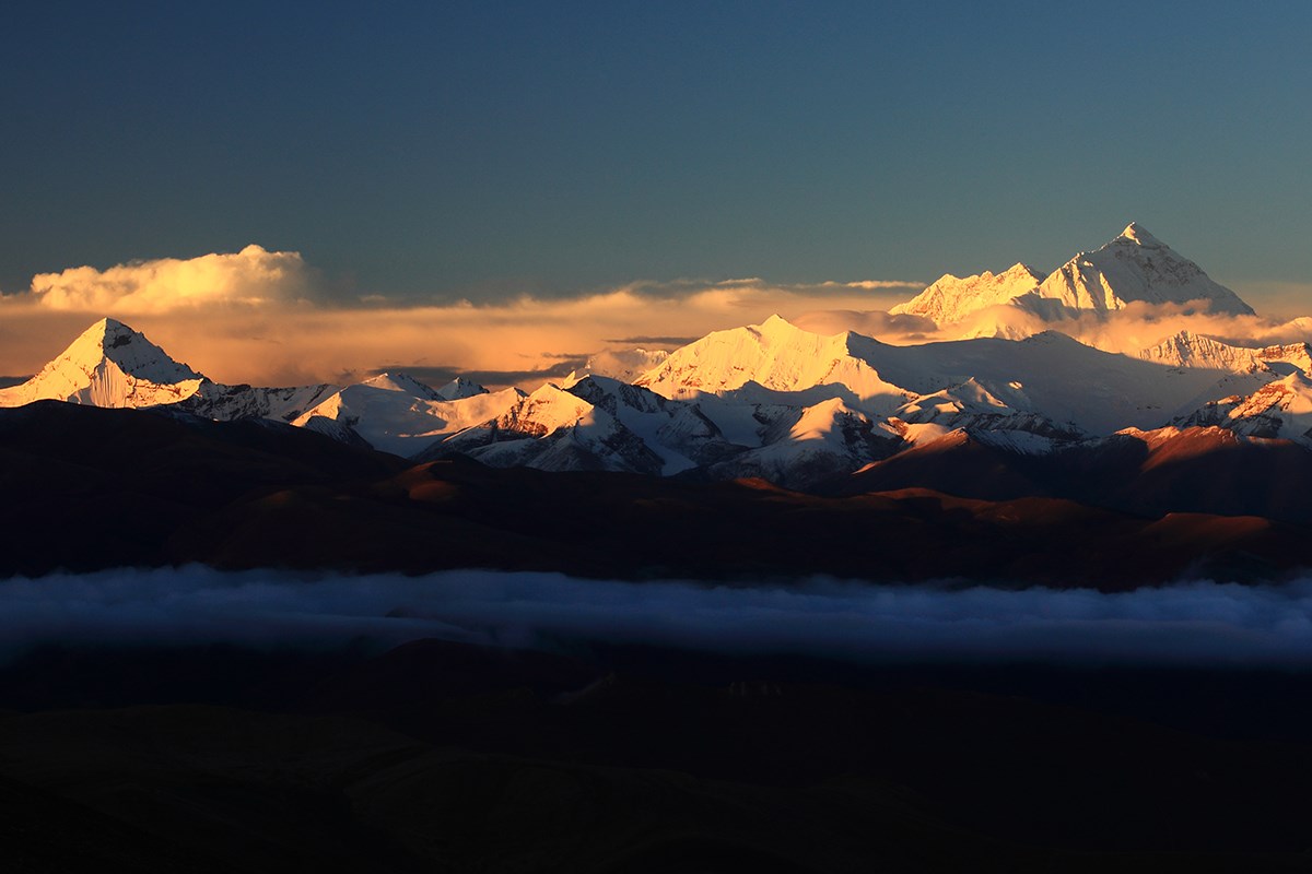
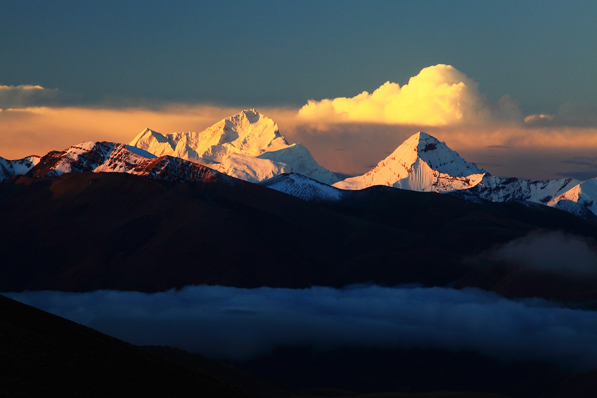
Qomolangma, shaped like a gigantic Pyramid and full of power and grandeur, towers into the sky while the land features are extremely precipitous and the environment usually complicated. The snow line of the north slope is 5800 - 6200 meters and that of the south 5500 - 6100 meters. Three great cliffs, which are generally named the North Cliff, the East Cliff and the Southwest Cliff, are embraced by the Northeast Ridge, the Southeast Ridge and the West Ridge. Between the ridges and cliffs scatter 548 continental glaciers, totaling an area of 1457.07 square kilometers, with an area of alpine glaciers exceeding 100,1000 square kilometers. The greatest flannel glacier, 26 kilometers long, has an average thickness of 120 meters with the thickest over 300 meters. The glaciers vary in types, the greatest being of upward 7260 meters in height. The constant supply of the glaciers is mainly offered by the metamorphism of accumulated snow of the two great precipitation belts in the monsoon belt of the Indian Ocean. In the glaciers, there are various kinds of surpassingly beautiful and rare forests of seracs (ice towers), cliffs of dozens of meters in height and open and hidden crevasses with lots of pitfalls here and there as well as the perilous area of ice and snow avalanches.
Not only is Qomolangma towering and grand, but very powerful. Twenty kilometers around it, groups of peaks stand in great numbers and the mountain ranges rise one higher than another. At least over 40 peaks are at an altitude of more than 7000 meters, among which the fairly famous are Lhoze (the fourth highest peak in the world at an altitude of 8516 meters) which is 3 kilometers on the south side, Zuoqong of 7589 meters, Makalu in the southeast (the fifth highest peak in the world at an altitude of 8463 meters), Zhangzi (3 kilometers in the north) at 7543 meters above sea level, Luzi on the west side (7855 meters) and Pumo Rize of 7145 meters above sea level. In the periphery of the gigantic peaks, some of the first class in the world stand far apart facing each other southeast (the third highest peak in the world at an altitude of 8586 meters, which serves as the boundary between Nepal and Sikkim); Gezhongkang (at an altitude of 7998 meters) in the east, Cho Oyo (Qowowugag) of 8201 meters and Xixabangma at 8027 at meters.
Due to the capricious climate in the Qomolangma area and the peaks around it, it is hard to foretell what the weather will be like in a single day, not even to mention the changeable climatic conditions in the four seasons of a year. Generally, the rainy season of a year lasts from early June to mid-September when the violent southeast monsoon brings about a harsh climate with frequent rainfall, mists veiling the air and unexpected snow of wanton persecution. Dominated by the strong north westerly cold cur rent from mid-November to mid-February of the next year, the temperature may be as low as - 50°C, the average being about - 30°C. Because of the greatest wind speed of 90 meters per second, the Himalayas are always viewed as "a forbidden zone" for alpinists in the windy and rainy seasons. Mountain climbing is most advisable from early March to the end of May in spring and from early September to the end of October in autumn when nice weather may be available and the windy season is making way for the rainy season.
The route line to the Himalayas from the Chinese side: It takes some two-day drive of a total of 670 kilometers along the Sino-Nepal Highway from Lhasa - Gyantse - Shegar. Then drive on for 110 kilometers along the simply-built highway down to the north foot of Qomolangma and further to Rongbuk Monastery at one end of Rongbuk Glacier. With an altitude of 5145 meters the Rongbuk is the highest monastery in the world. Rongbuk is only about 20 kilometers from the summit of Mount Qomolangma, it has become a base camp for climbing Everest from the north slope. This is a great place to enjoy the magnificent Mount Everest. Looking south from here, you can see the Mount Everest like a huge pyramid, majestic and solemn.
On a sunny day, what float over the peak of Everest and is similar to flag is Everest flag cloud. Flag cloud is formed convectional cumulus cloud. And people can deduce the wind force on the peak according to the flag cloud’s floating location and height, the more fluttering up the smaller wind and the more fluttering down the rather wind. If it is parallel with the peak, the wind force is about the 9th class. So the Everest flag cloud is reputed as “the highest wind indicator in the world”.
The towering Everest has been a mecca for humans to prove their ability to climb. Early since the beginning of the 19th century, alpinists and scientists all over the world had been looking forward to exploring Qomolangma, but it was not until 1953 that the mountaineer Edmund Hilary from New Zealand and the Sherpa Tenzing Norgay from Nepal succeeded in the first attempt to ascent the summit for the first time in human history.
1. The route line on the Southeast Ridge was discovered by a Swiss Mountaineering Team, but they failed in reaching the summit. In the next year, an English Mountaineering Team made it.
2. The route line on the Northeast Ridge was started by the Chinese Team in 1960 and they succeeded in getting to the summit.
3. The route line from the West Ridge to the North Cliff was opened up by an American Team in 1963 and they achieved success in the ascent of the summit.
4. The route line on the southwest slope was started by the English Boning Team in 1975 and they made the successful attempt of surmounting the summit.
5. The route line on the West Ridge was found out by the former Yugoslav Team and they succeed in getting to the summit.
6. The straight route line on the north slope was started by a Japanese Team in 1980, and they ascented the summit.
7. The route line on the Pillar Ridge of the south slope was opened up by the Polish Team in 1980, and they achieved success in conquering the summit.
8. The route line from the Northeast Ridge to the north slope was started in 1980 by Meisinaer alone, an Italian, who climbed to the summit.
9. The route line from the southwest slope to the West Ridge was opened up by the former Soviet Mountaineering Team in l982 and they reached the summit through this line.
10. The route line from the east slope to the South Ridge was started by the San Fransisco Bay Team of the USA. They surmounted the summit.
11. The route line on the west slope was opened up in 1988 by the US - New Zealand International Team who got to the summit. In the same year, the combined Mountaineering Team of China-Japan-Nepal undertook heroically to stride spontaneously across Qomolangma along the south and the north slopes and joined forces at the summit. Man is still trying hard to achieve magnificent wonders in surmounting Qomolangma.